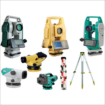
6 Geospatial and Field Engineering Package

Survey & Photogrammetry

MEASURE • MAP • MODEL

Learn land surveying, total station operation, levelling, GNSS, mapping, drone photogrammetry, point-cloud processing and practical field-project workflows.

Three Learning Levels Total Station and GNSS Drone Photogrammetry
Training Mode

Online and Offline

Core Skills

Field Survey and Mapping

Certification

Professional Certificate

Batch Options

Regular and Weekend

Survey and photogrammetry training
FIELD → DATA → MAP Complete geospatial workflow

Learn Practical Surveying and Digital Mapping

The Survey & Photogrammetry package combines conventional field surveying with modern digital mapping and image-based measurement techniques.

Students learn how to collect accurate field data, operate surveying instruments, process observations, create maps, generate terrain models and prepare professional survey deliverables.

  • Perform levelling, traversing and topographic surveys
  • Operate Total Station and GNSS equipment
  • Process coordinates and field observations
  • Create maps, contours and digital terrain models
  • Develop drone-photogrammetry and point-cloud projects
Three Levels — One Great Career

Select Your Survey Training Level

Begin with basic field surveying, advance to Total Station and GNSS workflows, and complete the Professional level with photogrammetry and a live mapping project.

Level 1

Basic

Recommended duration: 6–8 weeks

  • Surveying Fundamentals
  • Chain and Tape Survey
  • Compass Survey
  • Auto Level and Levelling
  • Basic Field Booking
Course Fee ₹7,500
Apply for Basic Level
Level 2

Intermediate

Recommended duration: 8–12 weeks

  • Total Station Operation
  • Traversing and Resection
  • Stakeout and Setting Out
  • GNSS Fundamentals
  • Survey Data Processing
Course Fee ₹13,500
Apply for Intermediate Level
Level 3

Professional

Recommended duration: 12–16 weeks

  • Drone Photogrammetry
  • Ground Control Points
  • Orthomosaic and DEM
  • Point-Cloud Processing
  • Live Survey and Mapping Project
Course Fee ₹20,500
Apply for Professional Level
Instruments and Technologies

Tools Covered

Learn the field instruments, digital workflows and mapping techniques used in modern surveying projects.

Auto Level

Levelling, reduced levels, profiles and cross-sections.

Total Station

Traversing, coordinate measurement, stakeout and mapping.

GNSS

Satellite positioning, coordinate systems and field control.

Photogrammetry

Image-based mapping, orthomosaics, DEM and point clouds.

Practical Applications

Projects You Can Learn to Perform

The training connects field observations with professional maps, models and engineering deliverables.

Topographic Survey

Collect terrain data and prepare contour and detail maps.

Route Survey

Survey roads, pipelines, canals and linear infrastructure.

Construction Setting Out

Transfer coordinates, alignments and levels to the field.

Drone Mapping

Generate orthomosaics, terrain models and point clouds.

Learning Methodology

Learn Through the Complete Survey Workflow

01

Plan the Survey

Understand objectives, accuracy, control and field methods.

02

Collect Field Data

Use levelling, Total Station, GNSS and aerial imagery.

03

Process Observations

Calculate coordinates, levels, adjustments and surfaces.

04

Prepare Deliverables

Produce maps, contours, models and survey reports.

Eligibility

Who Should Join?

ITI and Diploma Students

Surveying, civil engineering and related technical trades.

Civil Engineering Students

Learners seeking practical field and mapping skills.

Surveyors and Draftsmen

Professionals upgrading to Total Station and digital mapping.

Working Professionals

Engineers and technicians involved in field projects.

Frequently Asked Questions

Course Information

Yes. Beginners should begin with the Basic level, which covers surveying principles, levelling, field booking and conventional instruments.

Total Station operation and field exercises are included mainly in the Intermediate level, subject to equipment availability and the current batch plan.

The Professional level focuses on photogrammetry, image planning, ground control, processing and mapping. Actual drone operation depends on equipment, permissions and applicable regulations.

A CTI course-completion certificate is issued after completing the required classes, practical work and project assessment.

Build Practical Survey and Mapping Skills

Choose your learning level and submit the CTI online admission form. Our admission team will contact you regarding the next available batch.

Apply Now